Tuesday, August 25, 2015

New Jersey

We have arrived in Cape May, on the southern tip of New Jersey!  This will be our jumping off point for the commencement of our trip along the Jersey coast starting tomorrow.  The New Jersey ICW has continuous shoaling challenges with depths of only 3' in some areas making it prohibitive for many boats to use it.  So a boat with any keel at all must cruise on "the outside", that is, in the Atlantic Ocean.  

When cruising in economy mode, this 120 +/- mile trip is one l-o-n-g (10-11 hours) day.  A few times we've done it at night.  But the last couple of years we've broken up into two days, stopping in Atlantic City.  It makes it so much more enjoyable, especially with two dogs on board.  

Prior to reaching Cape May, we took a few days "off the water", and had some work done on the boat at one of our favorite yards, Washburns in Solomons, Maryland.  Those of us who have been there numerous times don't really give it much thought, but the site of the yard was the nation's first naval amphibious training base, training some 68,000 sailors, marines, and coast guardsmen and soldiers between 1942 and 1945. Seventy years later the buildings remain and are still actively used by the yard personnel.


Heading north through the northern Chesapeake Bay we then entered the mouth of the C&D Canal, docking at Chesapeake City.  (See my entry dated September 12, 2012 for information about and history of the C&D Canal.)


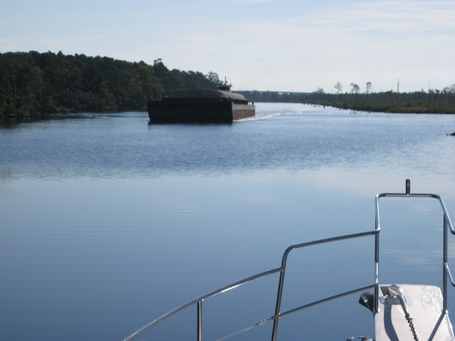
No sooner were we were tied up at a dock positioned right on the Canal, a  RORO vessel rolled past!  A RORO ("roll on, roll off") is designed to transport wheeled cargo, such as automobiles, trucks, and railroad cars that are driven on and off the ship on their own wheels or using a platform vehicle.  If you have ever seen one of these ships in open water, you know how big they are.  But when one is in a narrow Canal and right in front of you, they are positively massive.


The pilot boat is the red "dot" toward the stern of the ship


And then, we witnessed the pilot exchange!   I provided the pictures, but I give Wikipedia the credit for explaining how it works:

"Today's canal is a modern sea-level, electronically controlled commercial waterway, carrying 40 percent of all ship traffic in and out of the Port of Baltimore.
Since 1933 the Corps' Philadelphia District has managed canal and highway bridge operations from a two-story white frame building on the canal's southern bank at Chesapeake City, Maryland. Cargo ships of all sizes, tankers, container-carrying vessels, barges accompanied by tugboats, and countless recreational boats create a steady flow of traffic. Through state-of-the-art fiber optic and microwave links, dispatchers use closed-circuit television and radio systems to monitor and safely move commercial traffic through the waterway.

Navigating oceangoing vessels requires extensive maritime skills, with strong currents or bad weather conditions adding to the risks. A United States Coast Guard certified pilot is required for vessels engaged in foreign trade transiting the canal, the Delaware River and Bay, and Chesapeake Bay. Many shipping firms use pilots from the Delaware River and Bay or Maryland pilots' associations.

The pilot descends a ladder onto the pilot boat 
Typically a Delaware River and Bay pilot boards a ship as it passes Lewes, Delaware, entering the Delaware Bay, and guides the vessel up the bay and into the canal to Chesapeake City. A Maryland pilot then takes over and continues the ship's transit into the Chesapeake Bay to Baltimore or Annapolis, Maryland. The procedure is reversed for eastbound ships. At Chesapeake City a "changing of the pilots" takes place, while the pilot launch maneuvers alongside a vessel as it continues its journey without stopping. The pilots use the ship's gangwayJacob's ladder, or port entrance to climb aboard or leave the vessel."
I apologize for the fuzzy photo.  It's hard to photograph a moving object!   But it was thrilling to witness.  
We're on to NYC next!  

Wednesday, August 19, 2015

Leaving Serenity!

A barge passes us at a narrow part
of the ICW. 
There it goes, behind us. 


As we approached Norfolk, Virginia, the seagrasses, undeveloped acreage, and serenity of northern North Carolina gave way to sirens, horns, generators, train whistles, tug boats, and the hussle bussle of a busy port.


The serenity of the ICW in northern North Carolina

Here are some pictures of a new high-rise bridge which opened this year, replacing a bridge which opened only on the hour!  That restricted opening time made things very difficult, so everyone appreciates this new bridge (well, except maybe the tax payers!)


On the left you can see remnants of the old road; and on the
right is the former "office" of the bridge tender. 


Another shot of the former "office" of the bridge tender.


Norfolk is home to the largest Navy base in the world along with one of NATO's two Strategic Command headquarters.  It also has the corporate headquarters of Norfolk Southern Railroad.  The region plays a vital role in defense contracting, with particular emphasis in the shipbuilding and ship repair businesses. Many of the largest international shipping companies also are headquartered in Norfolk.


"Security" boats (above) guard the numerous aircraft carriers and other Naval ships docked for repair, including the USS Harry S. Truman, which we saw in port.

 
Working our way past Norfolk, we entered Chesapeake Bay which, thankfully, welcomed us with calm waters.  As this is a huge body of water (200 miles long, 30 miles wide), with the right elements, the Bay can be very rough.

Long range cruising is definitely not like driving a car!  It's not as simple as putting your car in "drive" and zooming down the highway, stopping for the night at one of numerous hotels when you've had enough.  Long range cruising, such as we're doing, is kind of like a puzzle where you have a number of variables to consider in determining the most timely and efficient way to safely reach your destination.  Of course, evaluation of the weather is really job one; and that entails more than watching The Weather Channel!  (What feels like a nice day on land can be entirely different on the water.)

John finds it an interesting challenge to examine our day's cruise and, depending on where we are, look at those variables which impact our progress.  These could be tidal currents or bridges and locks with restricted openings.  Based on these variables, we determine the time we start our day (usually at 7 am, but occasionally at 8), and consequently can determine the approximate arrival time at our destination (usually 4-5 pm).   Also, with regard to bridge openings, we make appropriate speed adjustments.  This is a major reason that we really appreciate having the ability on the Krogen Express to vary our speed (running from 8 kts up to twice that, if we want to).

In order to most efficiently plan the day you have to have good information......currents and their strength and direction, locations of bridges and how often they open (some are "on demand", some are on the half hour, others on the hour),  We are able to find all this information on an app we use on our IPAD from Garmin.  It incorporates information from the data base of a cruisers guide called Active Captain.  (www.activecaptain.com)  It provides info about bridges/schedules, marine facilities, fuel prices.


Sunday, August 16, 2015

North Carolina

As we've progressed north, cooler temps and lower humidity have welcomed us.  What an awesome greeting! We are most appreciative!

As we've passed - and stayed the night in - these little North Carolina towns along the ICW, I'm reminded of one of the major benefits of cruising.  We see things that you just can't see traveling in a car.... acres and acres of green sea grasses, miles of undeveloped forest and marshes.  There are also many small, sleepy towns and villages that depend upon boating visitors.  Last night we were in Belhaven, North Carolina.  Tonight it's Coinjock.  In fact, the ship's store at the marina has tshirts for sale that say "JustwherethehellisCoinjock?" !!

Have you ever heard of Belhaven or Coinjock?  In fact, I challenge you to find them on a map in less than 2 minutes!  But be sure you have a detailed map because they are tiny. However, cruisers are very familiar with them, and visit them often on their boat trips up and down the ICW.   In our years of boating, we have stayed in both of these spots numerous times.

Today John spent some time polishing stainless.  While this is not exactly his favorite task, we do strive to keep the boat in tip top shape.  But most of the time he is the eagle-eye captain at the helm, sometimes with a 4-legged crew member in his lap!


We also did some sit-ups on the bow. "How does that work?" you ask.  Well, we tied a line to each of the forward cleats to secure our ankles and put a towel under the line so we wouldn't get rope burn. Looks and sounds wierd, but it works!  And on the boat, you have to get creative about exercise.  In fact, I recall once cruising along the East River through New York City and seeing a woman on a sailboat using a stationary bike!


Zoey and M.E. enjoy the sites from the side deck 


Friday, August 14, 2015

We're Back!!

After a long absence, we are back to blogging! Welcome readers!

Since our last entry we have logged many hours up and down the east coast of the States and exhibited a boat in 17 boat shows; and in March 2014, we hosted a Krogen Express owner's rendezvous at Ocean Reef Resort in Key Largo, Florida. It was a fun three day event spent at a lovely spot with great folks!

We hope that all the Krogen Express fans, owners, and wanna-be owners will enjoy our entries this fall as we cruise north bound for Newport, Rhode Island, and then work our way south for shows in Maryland and Florida. We pride ourselves in identifying the Krogen Express owners as members of the Krogen Express “family”, and we hope that you will feel that way too through this blog.

If you would like to read earlier blogs, check out the blog “archive”. You can also find some postings on Facebook, if you would like to check that out.

Traveling with me and John are our two dogs, M.E., who is a 10 year veteran on the boat, and Zoey who is brand new to boating. (I can already see some good dog blog material in our future with these two!!)

And they're off.........
We departed from Hilton Head Island, South Carolina this morning, August 10. As it was home for us for about 11 years (and was the home of Betsie's parents for many years), we really enjoyed having a few days there. We went out the Port Royal Sound inlet into the Atlantic, and turned left, bound for Isle of Palms, just north of Charleston. Although a little choppy, it was a following sea, so it gave us a nice boost, allowing us to arrive ahead of schedule. In fact, we were able to meet up with some ol' college friends who were vacationing in the area! It's always fun to have surprise get-togethers like that!

Zoey enjoyed her first full day of boating, and fared very well. But, even more, she enjoyed the grass under her feet when we arrived at the marina!

Myrtle Beach Bound

The sun had just risen when we left Isle of Palms. That's such a nice time of day to be on the water when things are quiet; and that particular stretch of the Waterway is undeveloped and natural. The dolphin were riding our bow wave, the sun was peaking up over the green sea grasses, and I had my cup of coffee!! All was well with the world!! A few hours later the green-head flies arrived (ugh!) and the sun got hot! But the scenery along the Waccamaw River (see pic lower right) made up for it. Gorgeous! We arrived without incident at Barefoot Marina in Myrtle Beach about 5, plugged in the power cord, and cranked up the air conditioning. Ahhh.

The next morning, we cautiously proceeded through the “Rock Pile”. In the boating world, Myrtle Beach is known for the infamous “Rock Pile”, a man-made canal-like section of the ICW. It spans a distance of about 5 miles. The canal is narrow and lined with submerged rocks and a rock shelf, just a foot or two below the water’s surface. When the Army Corps of Engineers was building this portion of the ICW in the 1930’s they encountered a sold shelf of granite. The Corps simply blasted through this obstruction, but, over the years, the soft silt above and below this rocky outcropping has washed away, making the canal now appear wider than it really is. It can be very dangerous and costly to the inattentive captain. On the other hand, our Director of Yacht Services, Captain Andrea Gaines, has done it at night! She's good. Really good!

This picture to the left shows us passing a single file parade of boats traversing the Rock Pile.  You can't see the rocks, but they're there!

North Carolina


Every time we make this trip along the Intracoastal Waterway (ICW), we find more and more shallow (or “skinny”, as John calls them) areas. Chronic shoaling along the 1,100-mile section from Norfolk to Miami plagues everything from private yachts to tugs with barges, charter fishing boats and passenger vessels. This part of the ICW is made up of naturally deep estuaries, rivers and sounds connected by manmade "cuts" through land areas and shallows which has earned it the nickname "The Ditch." It is these cuts and dredged channels, as well as secondary channels running inland and connecting channels to ocean inlets, that require periodic dredging to keep traffic flowing. Unfortunately, the Federal government – and many State governments - keep cutting dredging budgets. This is why we appreciate the 4' draft on the Krogen Express. It would be pretty dicey if it were any more than that!